

What is Tropical Storm Dexter?
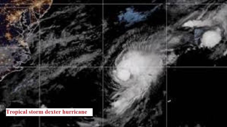
Tropical Storm Dexter is a newly formed weather system that’s currently making headlines across meteorological agencies, news outlets, and emergency services in the Atlantic region. Like other tropical storms, Dexter is a low-pressure system characterized by intense thunderstorms, strong winds, and the potential to intensify into a hurricane if conditions allow.
This storm is already demonstrating signs of growth and unpredictability, making it a storm to watch closely over the coming days. The National Hurricane Center (NHC) has issued preliminary advisories, and early model projections show possible landfall in vulnerable coastal areas.
Dexter’s development reflects a larger pattern of increasingly frequent and intense tropical systems in recent years, driven in part by warmer ocean temperatures and climate change.
Formation and Meteorological Background
Where Did Dexter Form?
Tropical Storm Dexter originated in the Eastern Atlantic, just off the coast of West Africa, an area known as the “Tropical Atlantic Main Development Region (MDR).” This region is notorious for spawning powerful cyclones, especially between August and October, during peak hurricane season.
Oceanic Conditions That Gave Rise to Dexter
Dexter’s birth is tied to several key meteorological ingredients:
- Warm sea surface temperatures (SSTs) exceeding 28°C (82°F)
- Low vertical wind shear, allowing the storm system to maintain vertical structure
- Moist air mass that fuels thunderstorm development
- Atmospheric instability due to rising warm air
Meteorologists have noted that the Atlantic Basin is unusually warm this season, contributing to faster storm intensification, something we’ve seen in several recent hurricanes.
Current Location and Trajectory of Dexter
Live Tracking Map and Coordinates
As of the latest update from the National Hurricane Center (NHC), Tropical Storm Dexter was located near 15.2°N latitude and 45.5°W longitude, moving west-northwest at 15 mph.
You can track the storm live using this official NOAA hurricane tracker.
Wind Speeds and Rainfall Patterns
- Sustained winds: 60 mph (97 km/h)
- Gusts: Up to 75 mph
- Pressure: 996 mb
- Rainfall: Forecasts suggest 4-8 inches across its projected path, with isolated areas reaching 12 inches
Dexter is causing rough seas and dangerous rip currents, affecting shipping routes and small island nations like Barbados, Saint Lucia, and Dominica.
Forecast Timeline: What’s Next for Dexter?
Short-Term Predictions (Next 72 Hours)
In the next 72 hours, Tropical Storm Dexter is expected to:
- Continue moving west-northwestward
- Encounter slightly more favorable conditions for strengthening
- Reach Category 1 hurricane strength within 48 hours, if trends persist
The NHC and European weather models (ECMWF) both predict a steady intensification due to warm water and low shear.
Long-Term Path (Up to 10 Days)
Long-range models show diverging paths:
- GFS model suggests potential landfall in the southeastern U.S., especially Florida or Georgia
- ECMWF model veers the storm northward, possibly brushing the East Coast or recurving into the Atlantic
There’s a lot of uncertainty beyond 5 days, but emergency preparedness is key, especially along the Gulf and Atlantic coasts.
Will Tropical Storm Dexter Turn into a Hurricane?
What Experts Are Saying
Experts from NOAA, AccuWeather, and The Weather Channel are issuing consistent warnings: Dexter has a high likelihood (70%) of becoming a hurricane in the next 48 hours.
Key factors supporting this:
- Warm waters in the Caribbean and Gulf
- Minimal wind shear
- Favorable upper-atmospheric support
Forecasters are comparing Dexter’s structure to Hurricane Elsa (2021), which intensified under similar conditions.
Hurricane Categories Explained
Here’s a quick refresher on hurricane categories:
| Category | Wind Speed (mph) | Damage Potential |
| 1 | 74–95 | Minimal |
| 2 | 96–110 | Moderate |
| 3 | 111–129 | Extensive |
| 4 | 130–156 | Extreme |
| 5 | 157+ | Catastrophic |
Dexter could reach Category 1 or 2, depending on its interaction with surrounding systems.
Areas at Risk: Potentially Affected Regions
Coastal Regions Most Vulnerable
Tropical Storm Dexter’s projected path places several coastal regions on high alert. The most at-risk zones currently include:
- The Lesser Antilles: Islands such as Dominica, Saint Lucia, and Barbados are already under tropical storm watches.
- Puerto Rico and the Dominican Republic: Heavy rainfall and flooding are possible if Dexter passes close.
- Florida’s East Coast: Forecast models suggest a potential U.S. landfall, making Florida a critical watchpoint.
- Southeastern U.S. States: Georgia, South Carolina, and North Carolina could face indirect effects from strong wind bands and rainfall.
Residents in these regions should monitor official advisories and be prepared for rapid changes in the forecast.
Emergency Weather Alerts and Warnings Issued
As of now, the following alerts are active:
- Tropical Storm Watches: Issued for portions of the Lesser Antilles
- Flood Advisories: Active in low-lying island communities
- Marine Warnings: Advising all ships in the eastern Caribbean to reroute
The National Weather Service (NWS) recommends having emergency kits ready, especially in zones where evacuations may be required on short notice.
Government Response and Evacuation Plans
Governments in affected regions are already taking action:
- Barbados and Saint Lucia have activated disaster response teams and are preparing public shelters.
- Puerto Rico’s Emergency Management Agency is reviewing flood-prone zones for evacuation routes.
- U.S. FEMA (Federal Emergency Management Agency) has positioned supplies in anticipation of possible landfall in the mainland.
Authorities urge citizens to sign up for local weather alerts, have evacuation plans ready, and keep vehicles fueled and emergency supplies stocked.
How to Prepare for Tropical Storm Dexter
Being storm-ready can save lives. Here’s how you can prepare effectively:
Essential Hurricane Preparedness Kit
A well-stocked emergency kit should include:
- 3-day supply of water and non-perishable food
- Flashlights and extra batteries
- Battery-powered or hand-crank radio
- First aid kit
- Prescription medications
- Personal hygiene items
- Power bank or solar charger
- Important documents in waterproof bags
Emergency Contacts and Resources
Keep these numbers and resources handy:
- FEMA Hotline: 1-800-621-FEMA (3362)
- Red Cross: https://www.redcross.org
- Local emergency numbers
- Mobile apps like FEMA, AccuWeather, and MyRadar for alerts
Download and print your evacuation routes, especially if you live in a flood-prone area.
Environmental Impact of Tropical Storm Dexter
Dexter is not just a threat to people — it also affects the environment:
- Deforestation due to strong winds uprooting trees
- Coral reef damage from turbulent waters
- Agricultural losses due to flooding
- Wildlife displacement, especially in coastal and forest ecosystems
Experts are also concerned about long-term coastal erosion, especially in Caribbean islands where beaches act as natural storm barriers.
Historical Comparison: Past Storms Like Dexter
Tropical Storm Dexter is being compared to:
- Hurricane Elsa (2021) – Similar path and strength, made landfall in Florida as a Category 1.
- Tropical Storm Bret (2023) – Another mid-Atlantic system that rapidly intensified before curving northward.
- Hurricane Dorian (2019) – While far more intense, Dorian showed how storms can suddenly stall and intensify.
This comparison helps forecasters and communities predict storm behavior and plan better responses.
Insurance and Property Protection Tips
Securing your home or business before a storm hits is essential:
- Review your homeowner’s or renter’s insurance for storm coverage.
- Take photos of valuables and structures for documentation.
- Install storm shutters or board up windows.
- Secure outdoor furniture, grills, and other objects.
- Clear gutters and drains to prevent flooding.
- Consider flood insurance — standard policies usually don’t cover flood damage.
What to Do During and After the Storm
During the Storm
- Stay indoors, away from windows
- Keep your phone charged and on silent emergency alert mode
- Monitor official weather reports and avoid misinformation on social media
After the Storm
- Wait for the all-clear from authorities before venturing out
- Watch for downed power lines and debris
- Avoid flooded areas — water may be contaminated or deeper than it appears
- Photograph any damages for insurance claims
Social Media and News Coverage
Keep up with the latest through trusted news outlets and official channels:
- CNN Weather
- The Weather Channel
- National Hurricane Center
- Twitter (X): @NHC_Atlantic, @fema, @weatherchannel
- Facebook: Follow state and local emergency management pages
Avoid spreading unverified rumors. Always cross-check from government agencies or mainstream news.
FAQs About Tropical Storm Dexter
- Is Dexter officially classified as a hurricane?
As of now, Dexter is still a tropical storm. However, it is forecasted to potentially strengthen into a Category 1 hurricane within 48 hours.
- Which states are most at risk?
Florida, Georgia, and the Carolinas are currently most at risk, depending on Dexter’s final path. The Gulf Coast and parts of the Mid-Atlantic are also on alert.
- How can I track Dexter in real-time?
Use official resources like:
- NOAA’s hurricane tracker
- AccuWeather app
- MyRadar app
- Will schools and airports shut down?
This depends on local authorities. In storm-affected areas, schools may close, and flights could be delayed or canceled. Always check with your local school board or airline.
- How do I know if I need to evacuate?
Listen for:
- Evacuation orders from local officials
- Emergency alert system (EAS) messages
- Text or radio alerts
Never wait until the last minute.
- Will Dexter impact oil production or trade routes?
Yes, if Dexter crosses the Gulf of Mexico, it could temporarily disrupt offshore oil platforms and shipping lanes in the region, affecting global supply chains.
Conclusion: Staying Safe Through the Storm
Tropical Storm Dexter is fast-moving and shows strong potential to evolve into a powerful hurricane. While its exact path is still uncertain, now is the time to prepare. Stay informed through official sources, stock up on essential supplies, review your insurance coverage, and have a family emergency plan ready.
Even if your area isn’t currently in Dexter’s path, weather patterns can change quickly. The key takeaway? Don’t panic, prepare.
External Links (Copy-Paste Format):
-
NOAA National Hurricane Center (Dexter Updates):
https://www.nhc.noaa.gov -
The Weather Channel (Storm Tracking): https://weather.com
-
FEMA – Hurricane Emergency Preparedness:
https://www.ready.gov/hurricanes -
American Red Cross – Disaster Relief:
https://www.redcross.org -
CNN Weather Coverage:
https://www.cnn.com/specials/weather
Disclaimer
This article is for informational purposes only. Weather predictions can change rapidly. Always rely on official government sources such as the National Hurricane Center (NHC), FEMA, and your local emergency management agency for real-time alerts, evacuation instructions, and storm updates.
Read also:
Massive Russia Earthquake Triggers Tsunamis Across Pacific 2025
Andrea Gibson 2025: Biography, Poetry, Cancer Journey, Documentary, and Legacy
Elon Musk’s Grok AI Faces Backlash Over Hitler References and Antisemitic Tropes